A way to bring development through football villages by uplifting local football clubs
To make locals support home grown football clubs in their regions instead of international ones by giving them a sense of belonging hence helping these clubs grow and contribute to the development of the regions through economy, environment and society.
"The power of a sports team in a community, it’s almost indescribable" - Wendell Pierce
*map drafted through secondary research of the region
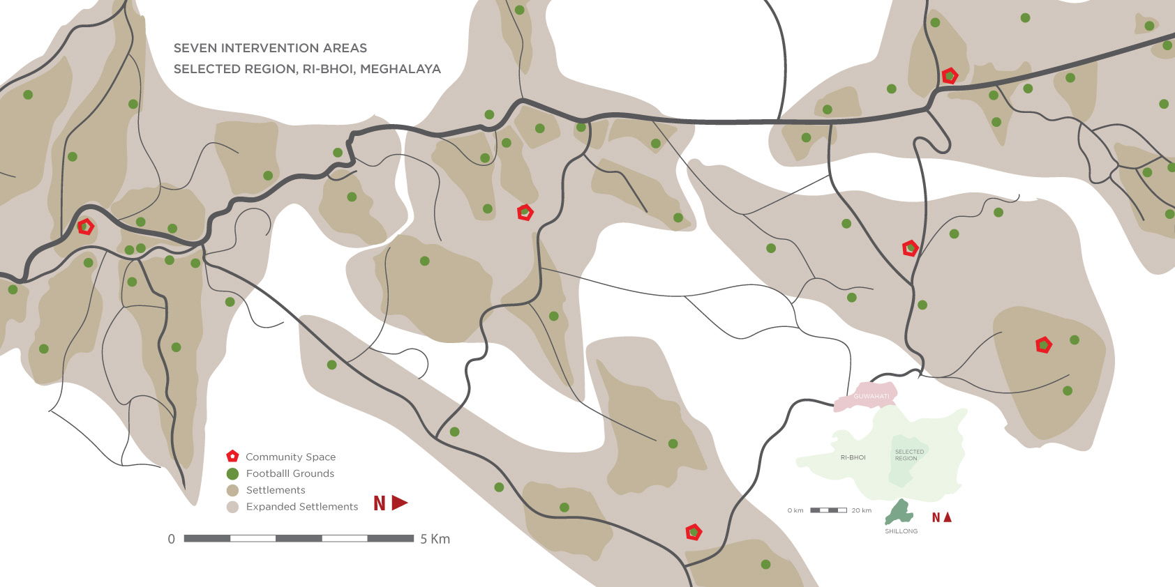
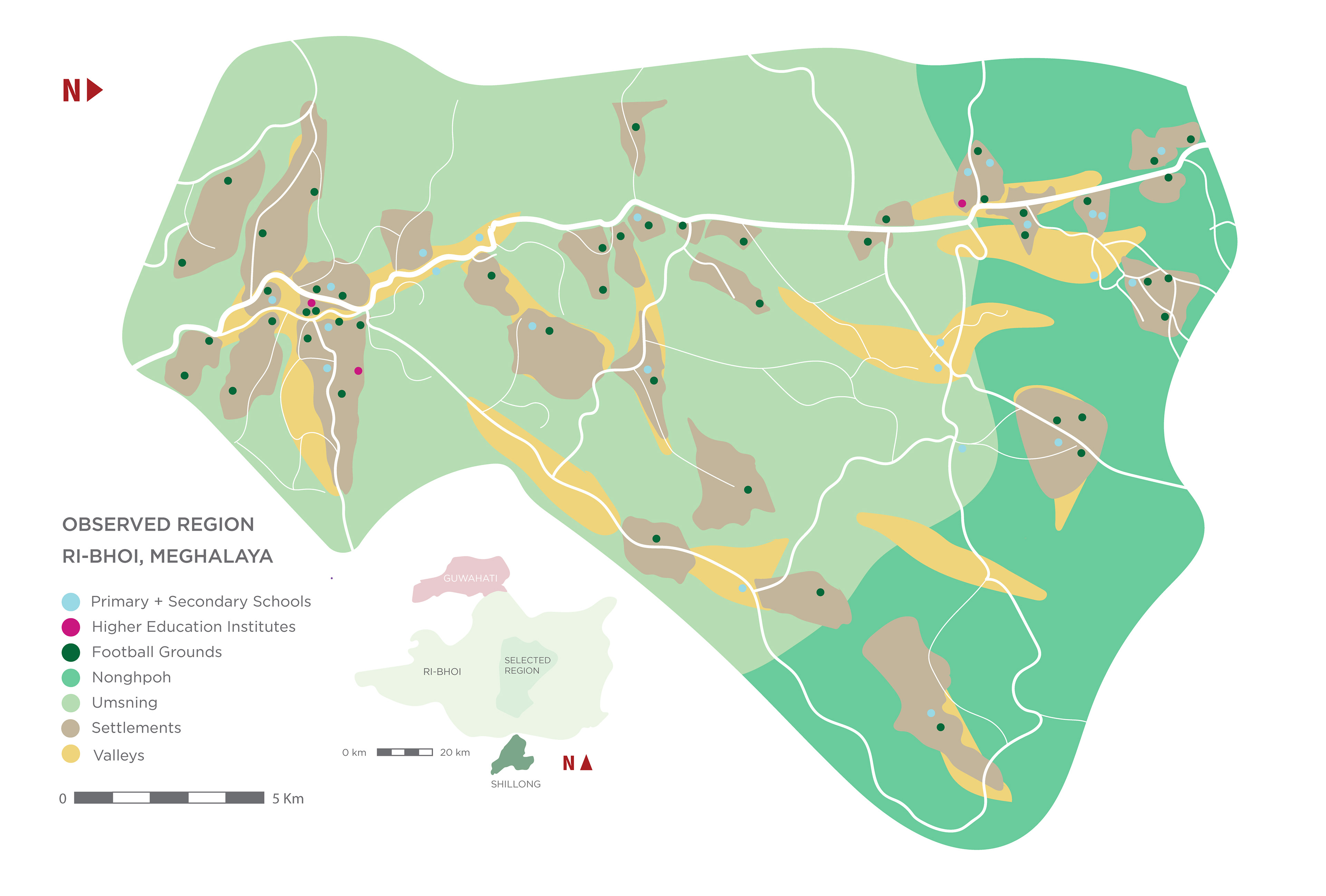
*an overlay of the concept on a map of Ri-Bhoi Village, Nonghpoh, Meghalaya; drafted through primary research; showing potential intervention areas and how can they be used
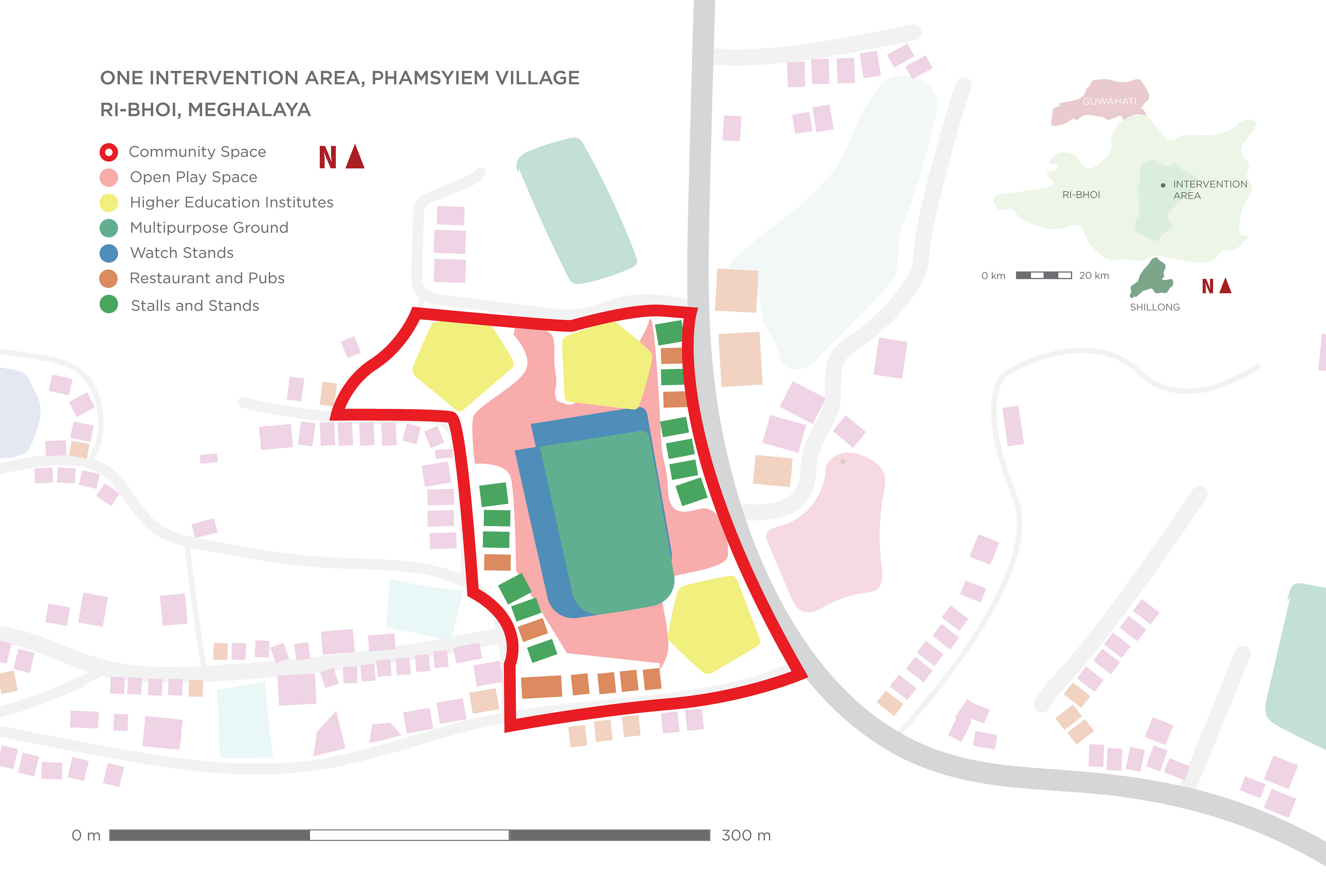
*an overlay of the concept on a map of Phamsyeim Village, Nonghpoh, Meghalaya; drafted through primary research
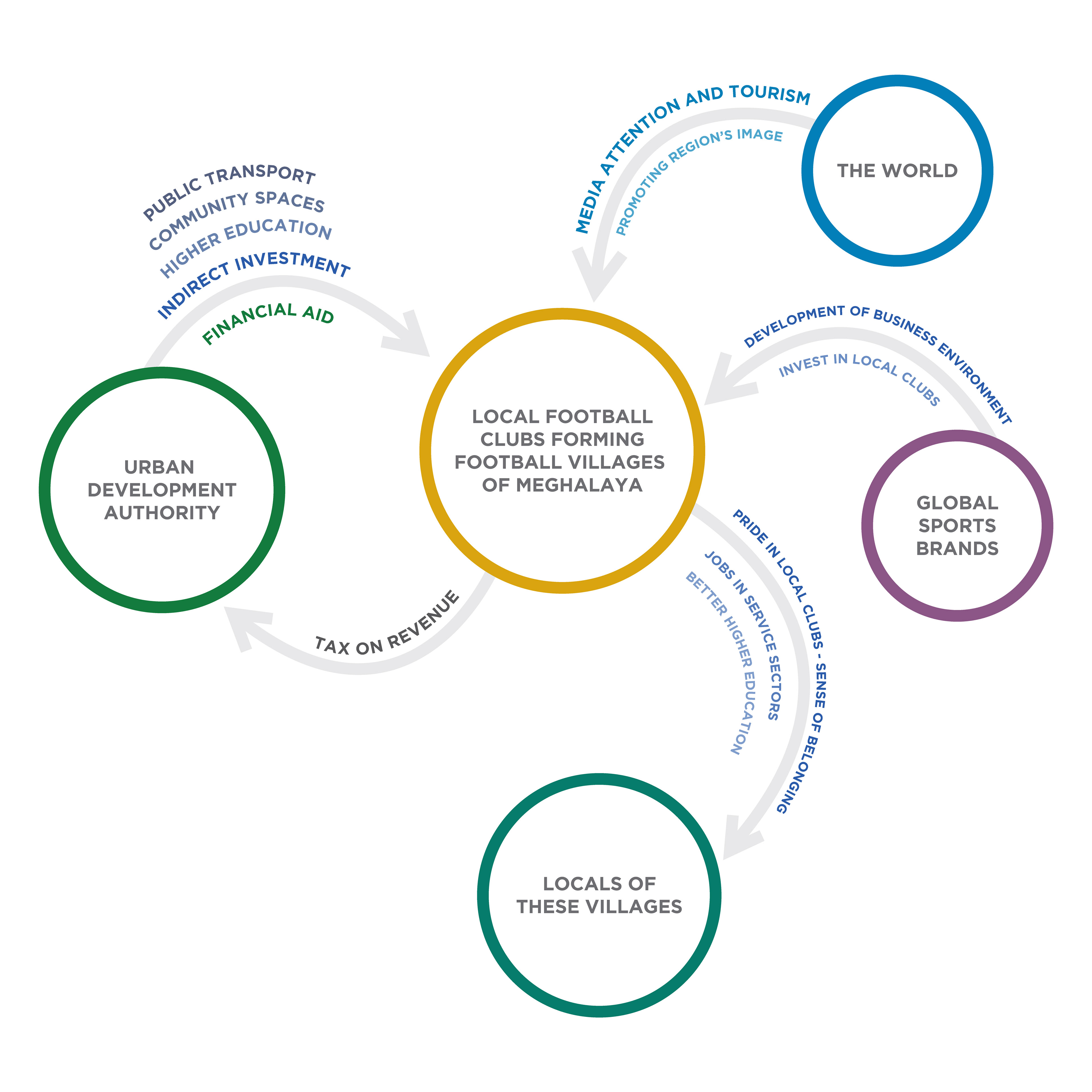
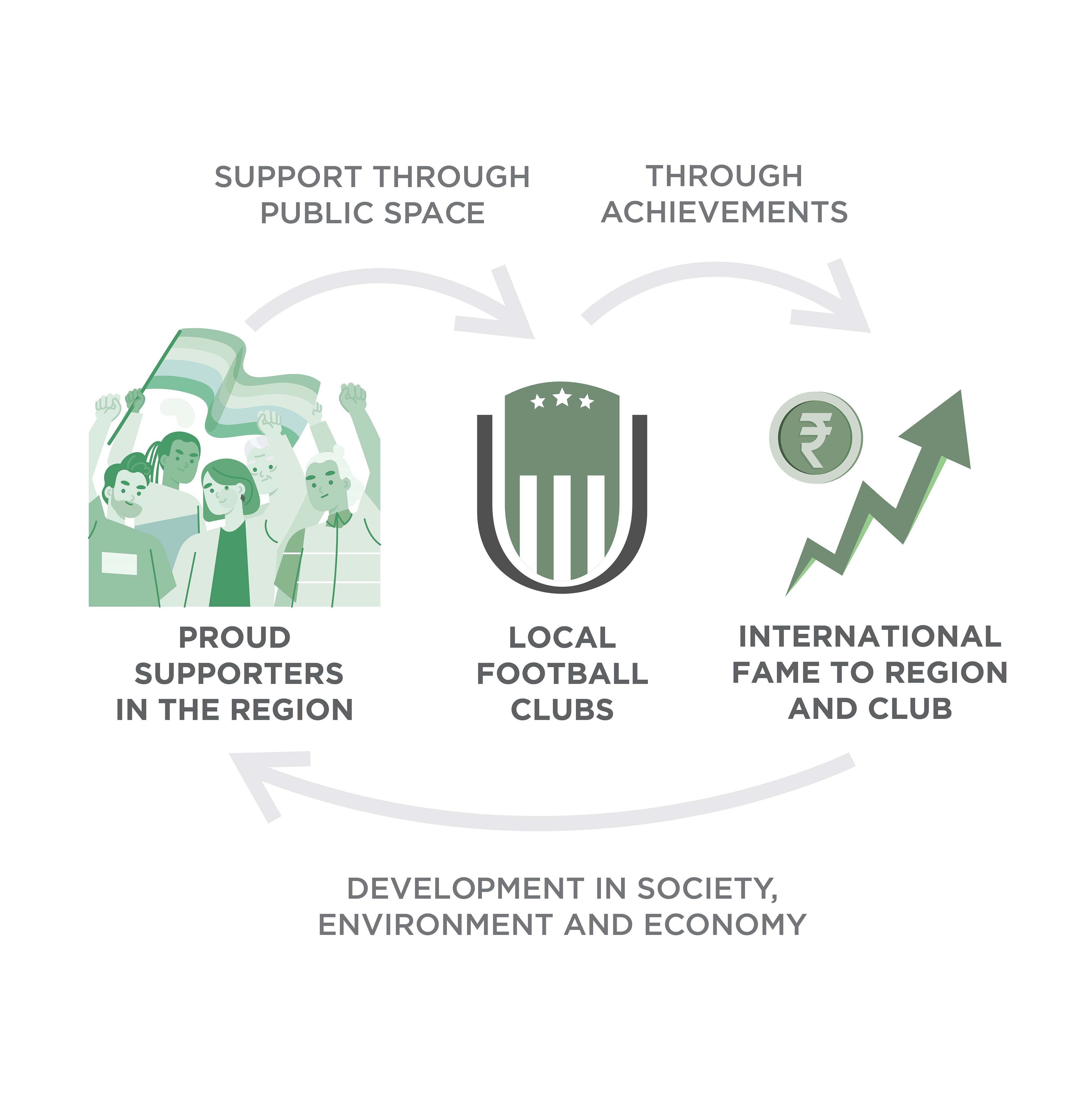
*a visual graphic made to communicate the implications on all stakeholders because of the proposed concept
*An overview of the project in manifested visuals - do read the design document in detail for a clear understanding

*An image from Phamsyiem Village in Nonghpoh, Meghalaya, while doing primary research
Client
Studio Archohm
Project Brief
To design research led concepts/strategies/policies for a proposal that Studio Archohm will be preparing about a city in Meghalaya (A state of India) that is in close proximity with Guwahati, Assam (A state of India )
My Role
Design Researcher and Strategic Designer
Design Researcher and Strategic Designer
I worked in researching and understanding the context of the region. Further analyzing how people live in cities, how they are built and then developing a concept of a city in Meghalaya.
Below is some curated context provided after a month long primary and secondary research of the region by the whole team.
*map of Meghalaya taken from public drafted maps on gov.meghalaya.in
Meghalaya
Tucked away in the hills of eastern sub-Himalayas is Meghalaya, one of the most beautiful State in the country. Nature has blessed her with abundant rainfall, sun-shine, virgin forests, high plateaus, tumbling waterfalls, crystal clear rivers, meandering streamlets and above all with sturdy, intelligent and hospitable people. The State of Meghalaya is situated on the north east of India. It extends for about 300 kilometers in length and about 100 kilometers in breadth.
Guwahati, Assam
Guwahati city lies along the Brahmaputra River. It is an important river port. Several Hindu pilgrimage centers and temple ruins are nearby. Among the city corridors, the most important is the corridor formed along the Guwahati-Shillong (GS) Road towards the south The GS Road corridor is an important commercial area with retail, wholesale and commercial offices developed along the main road.
Initial Inferences
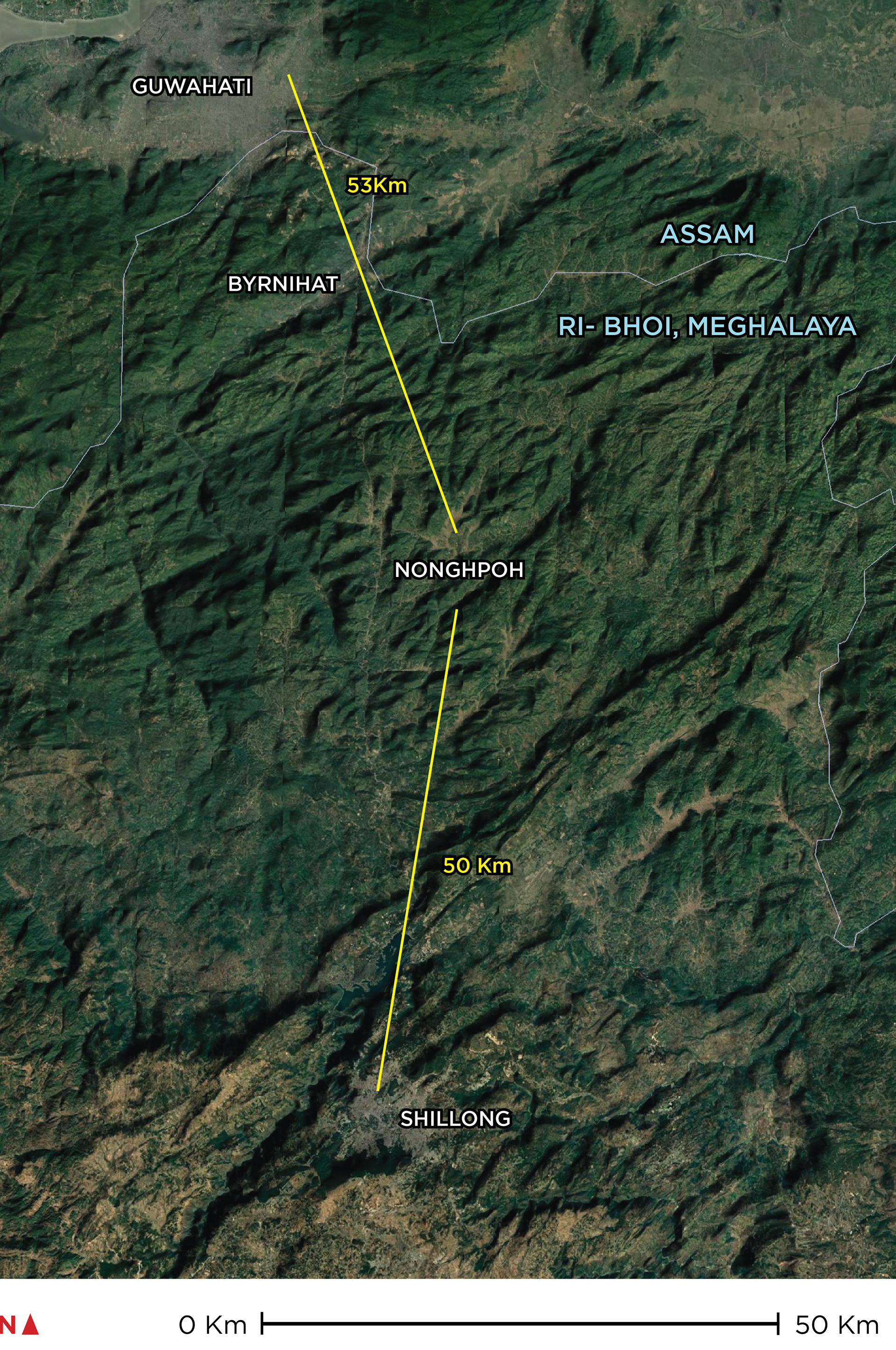
*satellite image of the region taken from google earth
The first of the inferences were that Meghalaya is a landlocked region and has only one low capacity airport in Shillong. Anyone who has to commute to this state has to reach to Guwahati Airport first then move to Meghalaya, hence we understood the reason behind making a proposal of a city near the border of Guwahati to take the advantage of the Airport there.
Another factor was ownership of land, here Non-tribal people and outsiders can’t buy any land to protect their cultural identity according to article 244, hence even the government has to by land from these people to build anything, thus people have a lot of power over what gets done in the sate.
Road infrastructure here still needs development and public transport is almost unknown to the region, only black and yellow Taxis are to be seen.
Max employment rate in the state is found in the East Khasi district due to the capital Shillong being there.
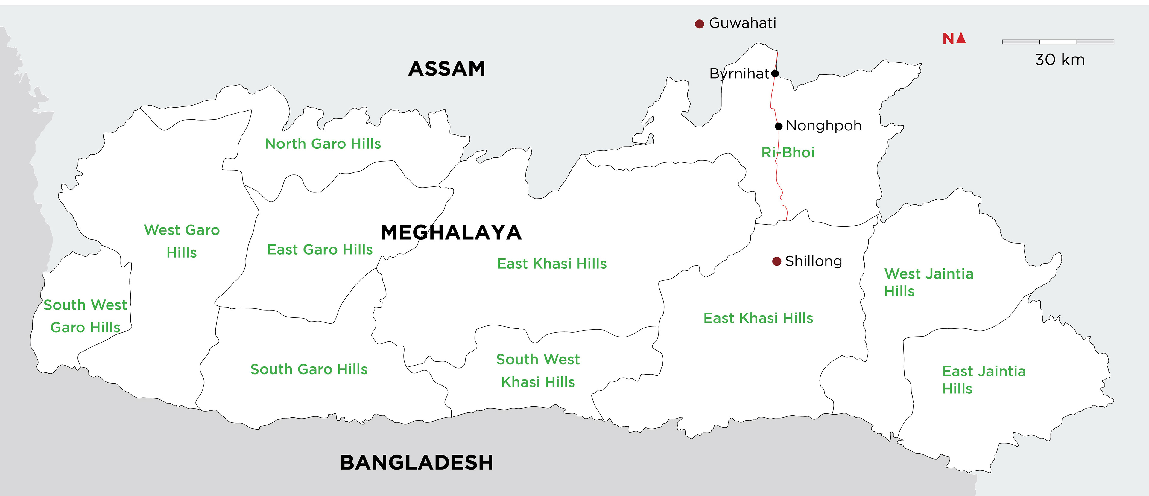
We found out that Ri Bhoi Distct in Meghalaya is the only one that shares a border with Guwahati hence we started researching more about the same.
Nonghpoh in Ri Bhoi was founded to be the central location between Guwahati and Shillong two major city centers near the district, at roughly 50 Km away from each.
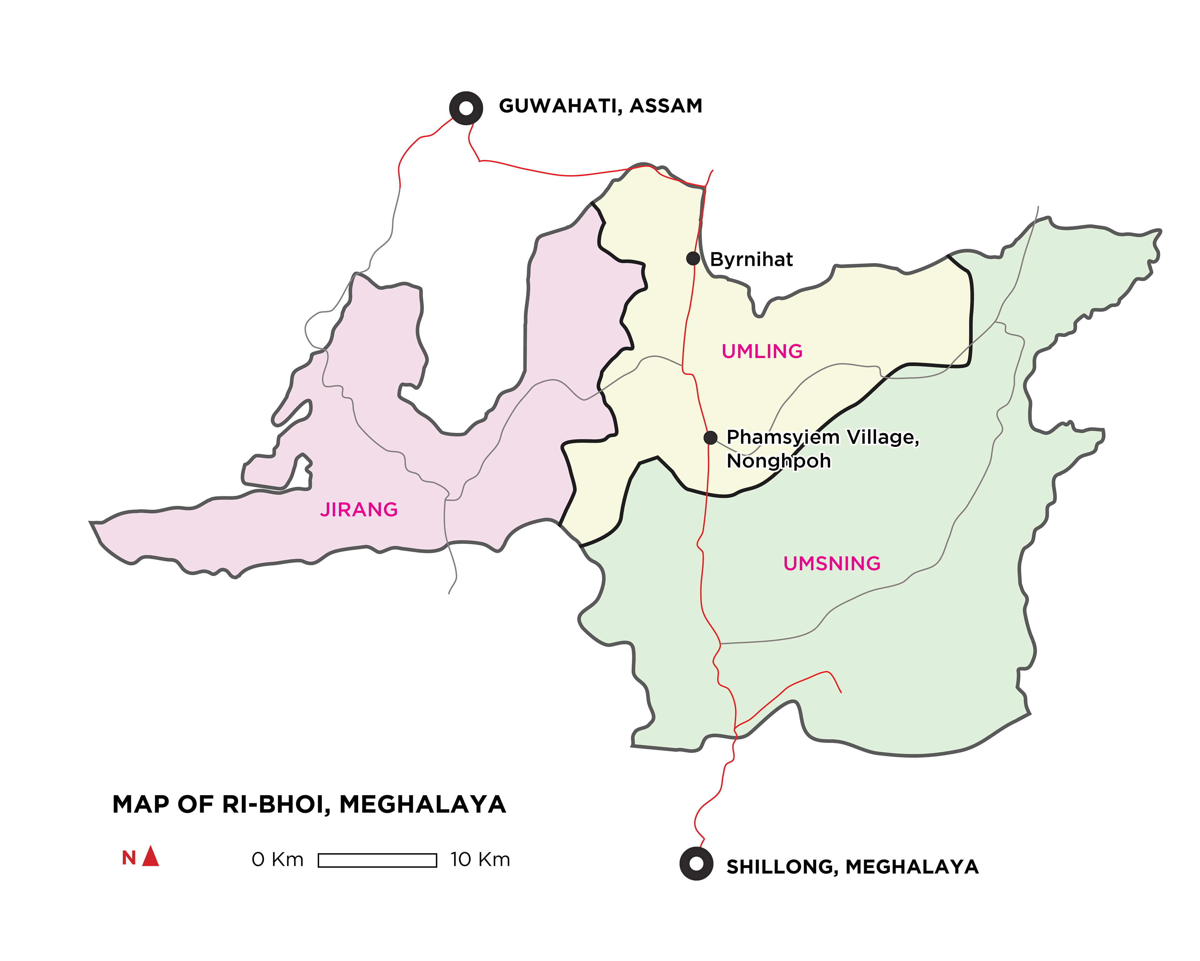
*map of Ri-Bhoi taken from public drafted maps on gov.meghalaya.in
Ri-Bhoi, Meghalaya
Population of Ri-Bhoi is less compared to its expansive area of 2400 Sq Km and a population of only 250,000 compared to that of Guwahati being 11,00,000 which is just a city with an area of 220 Sq km.
Climate patterns of the place suggests that Ri-Bhoi recieves the lowest rainfall out of all the other districts.
It is situated at a altitude ranging from 300 m to 800 m. Comapred to Shillong at 1900 m and Guwahati at 50m Ri Bhoi is a slant between these two. 85% of the population here belongs to the Khasi Tribe speaking Bhoi Language.
Phamsyiem Village, Nonghpoh, Meghalaya
The Village had a system of Kings and Chieftains where the king owns most of the land of the villages which is further given to people on lease to cultivate. Most people took part in farming as a primary activity but were also pretty educated as they had a primary and secondary school in the village itself.
Many people commune from Nonghpoh to Shillong and or Guwahati from here to take better jobs or education. Health care on the other hand was enough for people here due to the presence of two major hospitals and Nonghpoh being the administrative center for the Meghalaya's Government.
Many people commune from Nonghpoh to Shillong and or Guwahati from here to take better jobs or education. Health care on the other hand was enough for people here due to the presence of two major hospitals and Nonghpoh being the administrative center for the Meghalaya's Government.

*image taken while conducting primary research at Phamsyiem Village, Nonghpoh, Meghalaya